Historic Lists and their Limitations
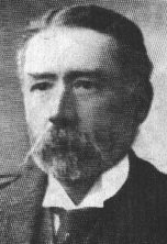
Hillwalking has grown massively in the UK over the last 150 years. The first mountaineering clubs were founded in the late 19th century, such as the Scottish Mountaineering Club in 1889. One of the founder members, Sir Hugh Munro, sought to list the most significant mountains in Scotland – those over 3000 ft. His work was pioneering because his list included 283 "separate mountains" while previously it was thought that there were only 30.

Sir Hugh also – perhaps unintentionally – set two further trends. Firstly, he triggered the "hillbagging" hobby where hillwalkers aim to complete a list. Secondly, there were some issues with his list that led to the creation of many further lists during the 20th Century. As well as detailing the 283 "separate mountains", Sir Hugh also identified a further 255 summits which, together with their parent, made a total of 538 'Tops'. These less important summits were listed beneath their parent in the text.
Another important development for hillwalkers was the various improvements that were made to Ordnance Survey maps during the 20th Century. The kilometre grid, providing a national system of grid references, was introduced in the 1940s. In the 1970s, more accurate surveys were carried out and contours and spot heights were recorded in metres rather than feet. Principal contours are at 50 m intervals and finer ones at 10 m intervals.

Today, there are a wide range of lists with differing advantages and disadvantages. The big "elephant in the room" is that the height and prominence criteria for most of these lists are based directly on feet or indirectly around the conversion of 50 feet to 15 metres. Most UK hillwalkers now use maps that are based on contours at 10 metre intervals; the most common being the Ordnance Survey Landranger 1:50 000 maps.
Other issues exist, such as the geographic fragmentation of the lists and the fragmentation of height and prominence criteria that are used to define the lists.
Some lists also suffer from weak prominence criteria. This can lead to a list with a mixture of demanding summits alongside others requiring little (vertical) effort. This is fine when the relative status is made clear (as for the Munros with "separate mountains" and "Tops") but where this is not done it can leave an important peak undifferentiated from its unimportant and undemanding subsidiary summits.
In conclusion, there is a fine history of hillwalking lists in the UK. Following any list will have its merits and involve good exercise and good views. However, many historic lists have deficiencies. There is a real need for a new generation of lists with the following characteristics:
- Metric based height and prominence criteria to match modern maps
- Demanding and differentiated prominence criteria.
- A consistent set of relevant criteria applied uniformly to all ranges in the UK
The UK Prominent Peaks database, along with hill lists based on it, aims to address this need.